US Photogrammetry Software Market Overview
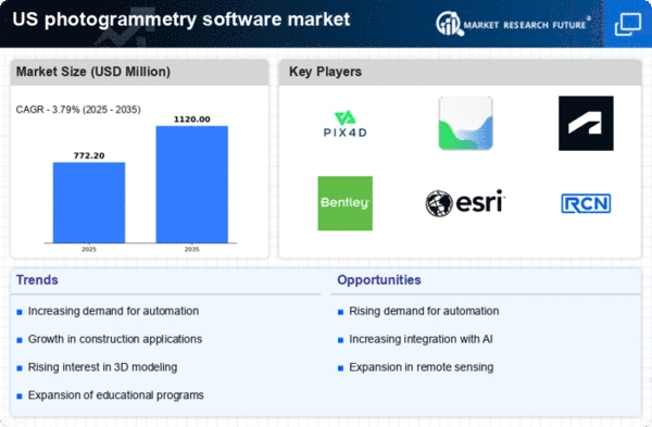
As per MRFR analysis, the US Photogrammetry Software Market Size was estimated at 550.76 (USD Million) in 2023. The US Photogrammetry Software Market Industry is expected to grow from 651(USD Million) in 2024 to 4,057.49 (USD Million) by 2035. The US Photogrammetry Software Market CAGR (growth rate) is expected to be around 18.098% during the forecast period (2025 - 2035).
Key US Photogrammetry Software Market Trends Highlighted
The US Photogrammetry Software Market is experiencing significant growth driven by several key factors. The increasing adoption of drones for surveying and mapping applications is a major market driver. Drones equipped with photogrammetry software have become essential tools for various sectors, including construction, mining, and agriculture. As the demand for accurate and efficient data collection rises, businesses across these industries are investing in advanced software that integrates seamlessly with drone technology. Additionally, the need for digital transformation in fields such as urban planning and environmental monitoring is pushing organizations to adopt photogrammetry solutions to gain better insights and enhance decision-making processes.
There are ample opportunities to be explored within the US market. The ongoing development of technologies such as artificial intelligence and machine learning can enhance the capabilities of photogrammetry software, allowing for more automated, precise analyses. Furthermore, as environmental concerns grow, industries are being encouraged to adopt sustainable practices, creating a demand for software that can efficiently manage and analyze land use and resource distribution. This provides software developers with the opportunity to innovate solutions that not only meet current industry needs but also address environmental challenges. Recent trends in the US Photogrammetry Software Market point toward increasing collaboration between software developers and industry professionals to tailor solutions that suit specific operational requirements.
The expansion of mobile-based applications is also notable, as it permits users to access photogrammetry tools on the go, making the technology more versatile and user-friendly. As the regulatory environment around drone usage continues to evolve, new opportunities will arise for compliant software solutions, further stimulating market growth in the region. Overall, the US Photogrammetry Software Market is poised for continued expansion, driven by technological advancements and the evolving needs of various sectors.
Source: Primary Research, Secondary Research, MRFR Database and Analyst Review
US Photogrammetry Software Market Drivers
Increased Adoption of Geographic Information Systems (GIS)
The US Photogrammetry Software Market Industry is experiencing significant growth due to the increased adoption of Geographic Information Systems (GIS) across various sectors such as urban planning, environmental monitoring, and transportation. According to the United States Geological Survey, the use of GIS is expected to grow by over 30% in the next five years, driven by the demand for real-time data analysis and mapping solutions. Established organizations like Esri are leading this trend by enhancing GIS integration with photogrammetry software, thereby facilitating better decision-making and resource management. As municipal governments increasingly incorporate GIS into their development projects, this trend is expected to further accelerate the adoption of photogrammetry solutions in the US.
Advancements in Drone Technology
The ongoing advancements in drone technology are significantly impacting the US Photogrammetry Software Market Industry. The Federal Aviation Administration reported a remarkable increase in commercial drone usage, which saw over 100,000 registered drones in the US by 2023. These drones are equipped with high-resolution cameras and sensors, allowing for precise data capturing and 3D modeling. Companies like DJI and Parrot are innovating in this space, providing businesses with advanced tools for capturing imagery that can be processed by photogrammetry software. The boom in drone use for applications such as agriculture, construction, and surveying is expected to foster a robust growth trajectory in this market.
Growing Demand for 3D Modeling in Various Industries
The demand for 3D modeling in industries such as construction, architecture, and gaming is fueling the growth of the US Photogrammetry Software Market Industry. Research from the National Association of Realtors indicates that the real estate industry is embracing 3D modeling to enhance property listings, with nearly 80% of agents reporting improved customer engagement. Companies like Autodesk are pioneering software solutions that integrate photogrammetry capabilities to support these needs. As more industries recognize the value of 3D visualizations in enhancing client experiences and operational efficiencies, the demand for photogrammetry software is expected to surge.
US Photogrammetry Software Market Segment Insights
Photogrammetry Software Market Photogrammetry Type Insights
The US Photogrammetry Software Market encompasses various types of photogrammetry, each contributing to the market dynamics and showcasing distinct characteristics essential for its growth and applicability. Aerial Photogrammetry is crucial in many sectors, including agriculture, urban planning, and environmental monitoring, due to its efficiency in capturing large areas quickly and effectively. Terrestrial Photogrammetry is increasingly recognized for its applications in construction and infrastructure, providing detailed 3D models that enhance project accuracy and safety. Close-Range Photogrammetry finds its significance in specialized fields such as archaeology and architectural preservation, where precise measurements and visual documentation are necessary for conservation efforts.
Moreover, Satellite Photogrammetry plays an integral role in geographic information systems (GIS), enabling large-scale mapping and analysis that supports various governmental and commercial applications. Underwater Photogrammetry has garnered attention for its utility in marine exploration, allowing for detailed mapping of underwater landscapes, which is critical for ecological studies and resource management. Lastly, the 'Others' category encompasses emerging technologies and methodologies that continuously evolve, highlighting the innovative nature of the photogrammetry landscape in the US.
The growth drivers behind these segments include the increasing demand for precise mapping solutions and the advancement in drone technology, which enhances the efficiency and accuracy of data capture. However, challenges such as the need for skilled professionals and the integration of photogrammetry data into existing workflows remain prevalent. Overall, the interplay of these segments showcases the diverse applications and significance of Photogrammetry Type within the broader US Photogrammetry Software Market.
Source: Primary Research, Secondary Research, MRFR Database and Analyst Review
Photogrammetry Software Market Deployment Mode Insights
The Deployment Mode segment within the US Photogrammetry Software Market exhibits significant variation in the adoption of On-premises and Cloud-based solutions. Organizations opting for On-premises deployment often value enhanced data security and control over their systems, which is critical in industries like construction, defense, and mapping. Conversely, Cloud-based solutions are gaining traction due to their flexibility, scalability, and cost-effectiveness, aligning closely with the growing trend of remote collaboration and real-time data access.
Notably, US government agencies and private enterprises are increasingly leveraging cloud technology to streamline projects and enhance operational efficiency. This shift not only supports faster data processing and dissemination but also aligns with the evolving needs for Advanced Analytics and Artificial Intelligence integration. As companies evaluate their deployment strategies, the increasing demand for seamless access to innovative photogrammetry tools will likely fuel further development in both On-premises and Cloud-based approaches, presenting diverse opportunities in the evolving market landscape. The choice of deployment mode fundamentally affects how organizations utilize photogrammetry software to meet industry standards and drive market growth.
Photogrammetry Software Market Pricing Model Insights
The US Photogrammetry Software Market exhibits a robust segmentation with a distinct focus on the Pricing Model. In this landscape, Commercial or Proprietary Software takes center stage, driven by its wide-ranging capabilities and support structures, making it the preferred choice for industries such as construction, mapping, and geographic information systems. This type of software is often characterized by advanced features, customer support, and regular updates, fostering its appeal among professionals who prioritize reliability and support for their projects.
Conversely, Open-Source Software provides a unique alternative in the market, attracting a diverse range of users including hobbyists and researchers due to its flexibility and cost-effectiveness. This segment frequently encourages innovation and collaboration, as users can modify the software to suit their specific needs. Both Commercial and Open-Source frameworks play critical roles in the advancement of photogrammetry solutions across the US, with each catering to different user demographics and preferences. The growing demand for accurate and efficient data capture in various fields, coupled with advancements in technology, positions these segments for notable growth in the coming years.
Photogrammetry Software Market End Use Vertical Insights
The End Use Vertical segment of the US Photogrammetry Software Market encompasses a diverse range of industries, reflecting the versatility and applicability of photogrammetry technology. The Architecture, Engineering, and Construction (AEC) sector is pivotal, as it increasingly adopts photogrammetry for creating accurate 3D models which enhance design and project visualization. Surveying and Mapping utilizes this technology to deliver precise topographic maps, which is essential for urban planning and environmental management. The Mining and Natural Resources sectors benefit from photogrammetry in resource estimation and land surveying, making operations more efficient and environmentally friendly.
Oil and Gas industries leverage this technology for exploration and pipeline management, optimizing site assessments and risk evaluations. Agriculture and Forestry applications utilize photogrammetry for precision farming, enabling better crop monitoring and resource management. Cultural Heritage and Archaeology employ photogrammetry to document and preserve historical sites with high levels of detail. Defense and Security rely on accurate terrain models for strategic planning and operations. The Manufacturing and Industrial sector is adopting photogrammetry for quality control and production efficiency.
In Film, Animation, and Gaming, photogrammetry generates realistic 3D environments, transforming visual storytelling. Lastly, Research and Education utilize this technology to advance studies in geographical sciences, spatial analysis, and related disciplines. Overall, this multidimensional engagement across various industries highlights the significance and growth potential of the US Photogrammetry Software Market, driven by technological advancements and increasing demand for precision and efficiency.
US Photogrammetry Software Market Key Players and Competitive Insights
The US Photogrammetry Software Market has been experiencing significant growth and is characterized by a diverse range of competitive dynamics. This market encompasses software solutions that facilitate the capture, processing, and analysis of photographic data to create accurate 3D models and maps. With the rise in demand for precision and advanced mapping solutions across various industries, including construction, architecture, and environmental management, numerous firms are vying for market share. The competition is intensified by rapid technological advancements that allow companies to innovate and enhance their offerings. The landscape is marked by established players who leverage their vast industry experience and emerging startups that bring fresh perspectives and disruptive technologies to the table. Bentley Systems stands out in the US Photogrammetry Software Market with its robust suite of engineering software solutions that cater specifically to infrastructure projects. The company is well-regarded for its commitment to providing high-quality design, modeling, and analytics tools that are essential for professionals involved in civil engineering and construction. Bentley Systems capitalizes on its extensive experience and deep industry knowledge, positioning itself as a leader in the market.
Their strength lies in their strong customer relationships, continuous product innovation, and a comprehensive ecosystem that integrates seamlessly with other tools. This holistic approach enhances their competitiveness in the photogrammetry space, enabling users to achieve superior results in project delivery and asset management.SimActive is another key player in the US Photogrammetry Software Market, known for its cutting-edge solutions tailored for professional aerial imagery processing and mapping. The company emphasizes its all-encompassing software suite that addresses various stages of the photogrammetry workflow, making it popular among surveyors and geospatial professionals. SimActive's strengths include its high-performance processing capabilities, user-friendly interface, and strong support for various data inputs. The company has garnered attention for its strategic collaborations and partnerships that enhance its offerings. Additionally, SimActive has pursued growth through key mergers and acquisitions, further solidifying its place in the market and expanding its product portfolio. By focusing on innovation and maintaining a customer-centric approach, SimActive continues to thrive in the competitive landscape of photogrammetry software within the United States.
Key Companies in the US Photogrammetry Software Market Include
- Bentley Systems
- SimActive
- Blue Marble Geographics
- DroneDeploy
- RealityCapture
- 3D Systems
- Pix4D
- Agisoft
- Hexagon AB
- Creaform
- Skydio
- Esri
- Autodesk
- Maxar Technologies
US Photogrammetry Software Market Industry Developments
The US Photogrammetry Software Market has seen significant advancements and developments recently. Bentley Systems has reported enhancements in their software offerings focused on improving data accuracy and workflow efficiency, while DroneDeploy has launched new features aimed at optimizing aerial imagery processing for various industries, including agriculture and construction. In September 2023, SimActive announced an update to their Correlator3D software, which enhances processing speed, a crucial factor as market demand grows. Recently, in October 2023, Blue Marble Geographics completed a strategic partnership with Esri to integrate their software solutions, leveraging both companies' strengths for improved geospatial data analysis. In terms of mergers and acquisitions, Hexagon AB acquired Gazef. This acquisition, announced in July 2023, aims to enhance Hexagon's capabilities in digital geospatial technologies. Market growth is expected to continue, driven by increasing demand in industries such as construction, land surveying, and environmental monitoring. As of mid-2023, major players, including Pix4D and Agisoft, have reported revenue growth, attributing advancements to increased adoption of drone technology and advancements in AR and VR applications. The US market is poised for further innovation as these companies continue to enhance their offerings.
US Photogrammetry Software Market Segmentation Insights
Photogrammetry Software Market Photogrammetry Type Outlook
- Aerial Photogrammetry
- Terrestrial Photogrammetry
- Close-Range Photogrammetry
- Satellite Photogrammetry
- Underwater Photogrammetry
- Others
Photogrammetry Software Market Deployment Mode Outlook
Photogrammetry Software Market Pricing Model Outlook
- Commercial/Proprietary Software
- Open-Source Software
Photogrammetry Software Market End Use Vertical Outlook
- Architecture
- Engineering
- Construction (AEC)
- Surveying and Mapping
- Mining and Natural Resources
- Oil and Gas
- Agriculture and Forestry
- Cultural Heritage and Archaeology
- Defense and Security
- Manufacturing and Industrial
- Film
- Animation
- Gaming
- Research And Education
Report Attribute/Metric Source: |
Details |
MARKET SIZE 2018 |
550.76(USD Million) |
MARKET SIZE 2024 |
651.0(USD Million) |
MARKET SIZE 2035 |
4057.49(USD Million) |
COMPOUND ANNUAL GROWTH RATE (CAGR) |
18.098% (2025 - 2035) |
REPORT COVERAGE |
Revenue Forecast, Competitive Landscape, Growth Factors, and Trends |
BASE YEAR |
2024 |
MARKET FORECAST PERIOD |
2025 - 2035 |
HISTORICAL DATA |
2019 - 2024 |
MARKET FORECAST UNITS |
USD Million |
KEY COMPANIES PROFILED |
Bentley Systems, SimActive, Blue Marble Geographics, DroneDeploy, RealityCapture, 3D Systems, Pix4D, Agisoft, Hexagon AB, Creaform, Skydio, Esri, Autodesk, Maxar Technologies |
SEGMENTS COVERED |
Photogrammetry Type, Deployment Mode, Pricing Model, End Use Vertical |
KEY MARKET OPPORTUNITIES |
Increased demand for drone applications, Growth in construction monitoring tools, Enhanced geospatial data analytics, Rising adoption in agriculture, Integration with AR/VR technologies |
KEY MARKET DYNAMICS |
increasing demand for accurate mapping, growth of drone technology, rising applications in construction, government investment in geospatial data, advancements in machine learning integration |
COUNTRIES COVERED |
US |
Frequently Asked Questions (FAQ) :
The US Photogrammetry Software Market is projected to reach a value of approximately 4057.49 million USD by 2035.
The market is expected to achieve a CAGR of 18.098 percent during the forecast period from 2025 to 2035.
Aerial Photogrammetry is anticipated to dominate the market, reaching a value of 900 million USD by 2035.
The market value of Terrestrial Photogrammetry is estimated to be around 120 million USD in 2024.
Major players in the market include Bentley Systems, DroneDeploy, Pix4D, Esri, and Maxar Technologies.
By 2035, Close-Range Photogrammetry is expected to reach a market value of 600 million USD.
Underwater Photogrammetry is projected to grow to 440 million USD by 2035.
The expected market size for Satellite Photogrammetry in 2024 is approximately 111 million USD.
Technological advancements and increasing applications in various industries are key trends driving market growth.
Challenges include data management complexities and competition among major players in the market.