Airborne LiDAR Market Summary
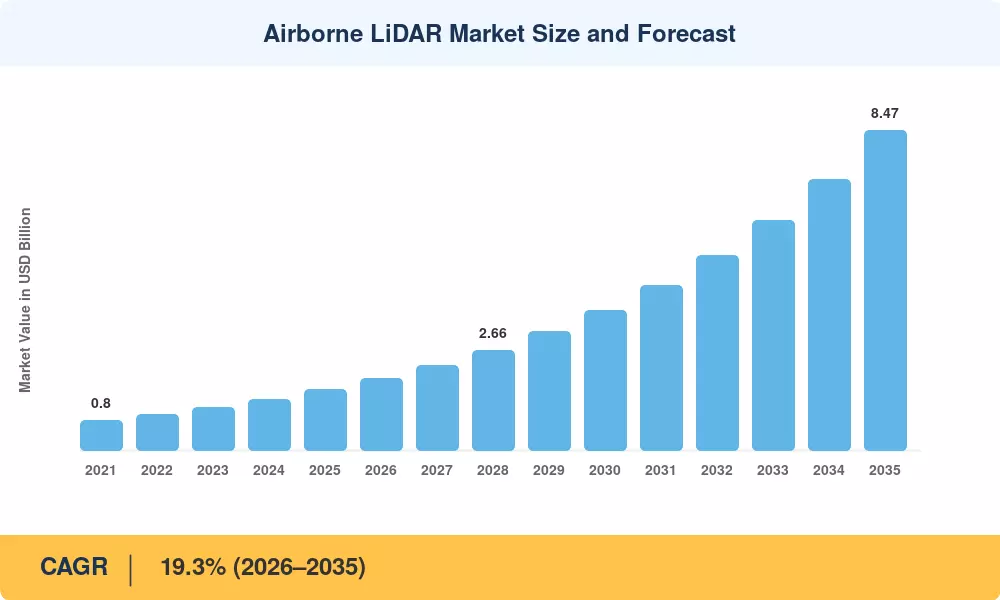
The Airborne LiDAR Market reached a valuation of USD 1.62 billion in 2025 and is projected to grow from USD 1.73 billion in 2026 to USD 8.47 billion by 2035, registering a CAGR of 19.3% over the forecast period. Government investments in national digital elevation programs and smart city infrastructure have accelerated the adoption of aerial LiDAR mapping survey technologies, with the U.S. Geological Survey's 3D Elevation Program alone allocating over USD 150 million annually to complete nationwide LiDAR topographic scanning coverage [2]. These mandated geospatial data acquisition programs serve as durable demand anchors for the Airborne LiDAR Market through the next decade.
A technological shift is underway as traditional photogrammetric survey methods give way to integrated LiDAR-equipped drone and manned aircraft platforms capable of capturing 3D terrain point cloud data at centimeter-level accuracy. The proliferation of single-photon and Geiger-mode sensors has cut acquisition costs by roughly 40% since 2021, while processing speeds for airborne remote sensing mapping workflows have doubled thanks to GPU-accelerated classification algorithms [3]. Forestry LiDAR analysis has become a mainstream application, with over 35 national forest inventories now relying on airborne platforms for canopy height modeling and biomass estimation [4].
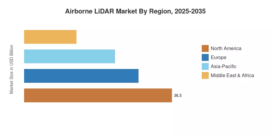
Asia-Pacific commands the largest regional share at approximately 36% of global revenue, driven by rapid urbanization across China and India and large-scale infrastructure mapping projects. North America is the fastest-growing region, posting a CAGR above 21%, propelled by USGS programs, corridor mapping for energy utilities, and defense modernization spending. Europe holds the second-largest share near 27%, anchored by EU Copernicus program investments and cross-border flood-risk mapping mandates The Airborne LiDAR Market is positioned for sustained double-digit expansion as digital twin and autonomous vehicle applications create fresh demand streams through 2035.
Key Report Takeaways
• By Type
- Topographic LiDAR accounts for roughly 68% of total revenue, driven by government elevation programs and urban 3D terrain point cloud data requirements
- Bathymetric LiDAR is expanding at approximately 22.1% CAGR as coastal nations invest in maritime surveillance and nearshore habitat mapping
• By Offering
- Hardware dominates the Airborne LiDAR Market with an estimated 61% share, reflecting ongoing sensor upgrades and fleet expansion across survey operators
- Services are projected to reach USD 3.58 billion by 2035 as managed aerial LiDAR mapping survey operations gain traction among end users without in-house capability
• By Region
- Asia-Pacific leads global demand, with China and India together contributing over 55% of regional revenue in the Airborne LiDAR Market
- North America is registering the fastest CAGR, underpinned by USGS 3DEP funding and expanding forestry LiDAR analysis contracts across Canada
- Europe's share sits near 27%, supported by EU Green Deal mapping mandates and cross-border airborne remote sensing mapping collaborations
Airborne LiDAR Market Size and Forecast (2021-2035)
The market sizing methodology combines bottom-up revenue aggregation from sensor manufacturers, platform integrators, and service providers with top-down validation using government procurement databases and satellite-vs-LiDAR substitution modeling. Historical figures (2021–2024) are derived from audited financial disclosures and customs trade data; forecast projections (2026–2035) apply a compound annual growth rate calibrated to macro drivers including smart city investments, defense budgets, and climate adaptation spending.